

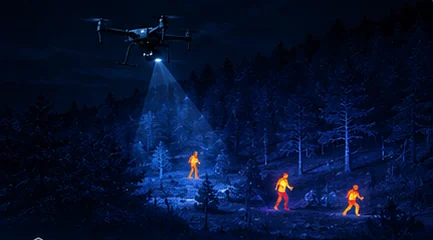
A person in water is a strong thermal target against cold sea — a 640×512 payload detects a head-and-shoulders signature hundreds of metres out, at night, in conditions where visual search from a vessel finds nothing.
- Head & shouldersAll that shows above water
- First hoursWhen contrast is highest
- 2,000 mLongest LRF in the line
- Down-driftWhere to search
Key takeaways
- Cold water strips body heat fast, so early detection decides outcomes and thermal contrast is highest in the first hours.
- Search down-drift using wind and current models — the search area moves, and a static grid searches where the subject was.
- Overwater conditions push 640-class thermal, long zoom and ranging up the priority list, because everything happens at distance.
- Salt fog attacks connectors and coatings, spray demands sealing, and horizonless scenes stress stabilisation.
On this page
Overwater Specifically
This guide covers what changes when the search is over water. The kit list for a SAR team is in the SAR drone equipment checklist, and pattern selection is in search patterns for thermal drone SAR. Almost everything in both still applies offshore — what follows is the delta.
That delta is substantial. The target presents differently, the search area moves, the environment attacks the hardware, and there is nowhere to land.
Person-in-Water Search
A person in water is one of the better thermal targets in SAR, for a reason that is also the tragedy of the mission: the sea is cold and the person is not, so the contrast is strong. A 640×512 payload picks up a head-and-shoulders signature hundreds of metres out at night, in conditions where a visual lookout on a vessel deck sees nothing at all.
But cold water strips body heat fast, and that governs everything about how the mission is run. Thermal contrast is highest in the first hours and declines as the subject cools — which means detection probability is falling while you search, and the argument for launching immediately rather than waiting for a better-equipped asset is stronger over water than over land.
Note what the target actually is. Only head and shoulders are above the surface, and water blocks LWIR entirely, so the submerged body contributes nothing. You are looking for a very small warm object in a large field of clutter — which is why resolution and altitude discipline matter more here than in most searches, and why the DRI figures for a standing person are optimistic for this geometry.
Search patterns should sweep down-drift with wind and current models. A person in water moves, sometimes surprisingly fast, and a grid anchored to the last known position searches where the subject used to be. Getting drift into the plan is the highest-leverage decision in maritime SAR and it is a coordination task as much as a flying one.
Vessel and Coastal Monitoring
Vessels are the opposite problem: unmistakable thermal targets. Wake and engine heat make a boat conspicuous in LWIR even when it is running dark, and a hull that has been under way carries a thermal signature that persists after the engine stops.
Zoom identification plus rangefinder position reporting supports interdiction and rescue coordination alike. The workflow is the same in both cases — thermal detects the contact at range, optical zoom establishes what it is, and the rangefinder converts the observation into a coordinate that a surface asset can be vectored to. Why an LRF belongs on your payload covers the coordinate chain, and maritime SAR and coastguard drones covers the operational programme.
Coastal monitoring blends into port and harbour surveillance, where the same payload characteristics serve a security rather than rescue purpose.
Overwater Payload Realities
Four environmental factors change the specification, and each of them pushes in the same direction.
| Factor | Effect | What it demands of the payload |
|---|---|---|
| Salt fog | Attacks connectors and coatings over time | Sealing, corrosion-resistant finishes, post-flight rinse discipline |
| Spray | Direct water ingress on low passes | Ingress protection rated for the exposure |
| Horizonless scenes | Few visual references; stabilisation has less to lock onto | Tight pointing accuracy and reliable attitude estimation |
| Distance | Everything happens further away than over land | 640-class thermal, long optical zoom, long-range LRF |
Sealing deserves particular attention because the failure is gradual rather than immediate. A payload flown in salt air performs normally for months and then develops connector problems that are difficult to diagnose and expensive to fix. What IP67 really promises covers how to read the ratings, and gimbal camera maintenance covers the rinse-and-inspect routine that extends service life materially.
The horizonless point is subtler. Over open water there is little visual structure, and both the operator and any vision-based aircraft systems have less to work with. This is where pointing accuracy and attitude fusion quality stop being datasheet lines and become the difference between a usable long-range image and a drifting one.
Recommended Payloads
Distance drives the choice offshore more than anywhere else in this catalogue.
| Payload | Zoom | Thermal | Ranging | Best fit |
|---|---|---|---|---|
| LX-9B | 30x optical / 120x hybrid | 640×512, <50 mK | 5–2,000 m | Offshore standoff work |
| OP-90A | 10x optical / 30x hybrid | 640×512, <50 mK | 5–1,200 m | Balanced EO/IR for nearshore SAR |
| MV-4X | Digital | Uncooled VOx | 5–2,000 m | Ship-launched small UAS |
The LX-9B is the offshore answer because 30x optical and 2,000 m ranging let the aircraft work at a distance that keeps it recoverable. The MV-4X earns its place for ship-launched operations, where deck space and launch handling matter more than reach — a 366 g pod is something a crew can launch by hand from a moving vessel.
Conditions and Honest Limits
Sea state degrades detection without eliminating it. Whitecaps add clutter — bright, moving, roughly target-sized features across the whole search area — and spray attenuates signal. Detection ranges drop as sea state rises, but they remain far beyond what night visual search from a vessel achieves, which is the comparison that matters operationally.
Fog behaves as it does everywhere: light fog is workable, dense marine fog attenuates LWIR along with everything else. The practical response is to plan altitude under the ceiling and tighten lane spacing to compensate for reduced detection range. Fog, rain and humidity limits covers the general case.
Two limits worth stating plainly. There is nowhere to land, so endurance reserves and loss-of-link behaviour need to be planned with more conservatism than over land. And a subject who has been in cold water long enough loses the thermal contrast that made them findable — which is the physical reason maritime SAR is a race rather than a search.
Related reading
- IMU, AHRS and Attitude Fusion
- Starlight and Low-Light Imaging
- The SAR Drone Team Equipment Checklist
- Search Patterns for Thermal Drone SAR
- Why a Laser Rangefinder Belongs on Your UAV Payload
- IP Ratings on UAV Payloads: What IP67 Really Promises
- Gimbal Camera Maintenance
- Thermal Drones in Fog, Rain and Humidity
- LX-9B — 30x optical, thermal and 2,000 m ranging
- OP-90A — balanced EO/IR with ranging
- MV-4X — micro quad-sensor pod
- Maritime SAR and Coastguard Drones
FAQ
Does sea state kill thermal detection?
It degrades it substantially without eliminating it. Whitecaps add clutter — bright, moving features roughly the size of the target, spread across the entire search area — and spray attenuates the signal. Detection ranges drop as sea state rises. They nonetheless remain far beyond what a lookout on a vessel deck achieves at night, which is the comparison that decides whether the aircraft is worth launching.
Can thermal see through fog offshore?
Light fog, usefully; dense marine fog attenuates long-wave infrared much as it does visible light. The practical response is to plan altitude under the ceiling and tighten lane spacing so that reduced detection range does not open gaps in coverage. Do the lane arithmetic against your degraded range rather than your clear-air figure — a pattern flown at clear-air spacing in fog searches less area than it appears to.
Why search down-drift rather than around the last known position?
Because a person in water moves with wind and current, sometimes faster than intuition suggests. A grid anchored to the last known position searches where the subject was rather than where they now are, and the error grows with every hour. Getting a drift model into the search plan is the highest-leverage decision in maritime SAR, and it is a coordination task with the surface controller as much as a flying one.
Questions about the technology? Talk to our engineers — we reply within 2 business days.